
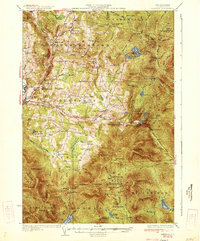
1934 Map of Dixville
USGS Topo · Published 1934About this map
Stewartstown, Colebrook, and Columbia define the western reaches of this Coos County landscape, where rural life in the 1930s centered on an extensive network of district schools and remote timber camps. Small settlements like Stewartstown Hollow and Kidderville are connected by winding valley roads, while the higher elevations are marked by isolated outposts such as Felton Camp and Old Ramsey Camp. The topographic data reveals a transition from the agricultural river valleys to the steep notches and peaks of the east.
Find a feature on this map
118 named features on this map. Tap any name to fly to it.
Don’t see what you’re looking for? This feature index may not catch every label — zoom into the map to look around manually.
Map Details
Editions of this 1934 Dixville Map
2 editions found
Other maps of this area

1920 · Guildhall
USGS Topo · 1:62,500

1925 · Indian Stream
USGS Topo · 1:48,000

1926 · Indian Stream
USGS Topo · 1:62,500

1927 · Indian Stream
USGS Topo · 1:62,500

1927 · Second Lake
USGS Topo · 1:62,500

1929 · Averill
USGS Topo · 1:62,500

1930 · Milan
USGS Topo · 1:62,500

1930 · Percy
USGS Topo · 1:62,500

1930 · Dixville
USGS Topo · 1:62,500

1930 · Errol
USGS Topo · 1:62,500