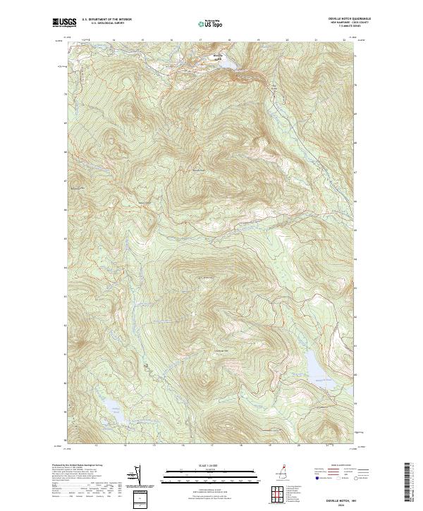
2024 Map of Dixville Notch
USGS Topo · Published 2024About this map
Dixville Notch serves as the focal point of this mountainous landscape in Coos County, where the topography is defined by the sharp elevations of Dixville Peak and Mt Kelsey. The area is characterized by a dense network of water features, from the high waters of Lake Gloriette near the notch to the expansive Millsfield Pond in the southeast. Historical travel routes and modern recreation paths, including the Sanguinary Ridge Trl and Kelsey Notch Trl, navigate the steep grades between peaks such as Owlhead Mtn and Baldhead Mtn. The drainages of Phillips Brook and Clear Stream carve through the terrain, revealing geological landmarks like The Flume and the curiously named Devils Washbowl. This map documents a region largely preserved in its wild state, dominated by high-altitude ponds and naming conventions that reflect a long history of local navigation through the notches.
Find a feature on this map
48 named features on this map. Tap any name to fly to it.
Don’t see what you’re looking for? This feature index may not catch every label — zoom into the map to look around manually.
Map Details
Editions of this 2024 Dixville Notch Map
This is the sole edition of this map. No revisions or reprints were ever made.
Other maps of this area

1930 · Milan
USGS Topo · 1:62,500

1930 · Percy
USGS Topo · 1:62,500

1930 · Dixville
USGS Topo · 1:62,500

1930 · Errol
USGS Topo · 1:62,500

1933 · Dixville
USGS Topo · 1:62,500

1933 · Milan
USGS Topo · 1:62,500

1934 · Percy
USGS Topo · 1:62,500

1934 · Dixville
USGS Topo · 1:62,500

1934 · Errol
USGS Topo · 1:62,500

1934 · Milan
USGS Topo · 1:62,500