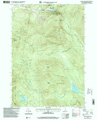
1996 Map of Dixville Notch
USGS Topo · Published 2000About this map
Dixville Notch State Park anchors this terrain in the northern White Mountains, where the narrow pass of Dixville Notch cuts between the steep slopes of Sanguinary Mountain and the prominent Table Rock. The landscape is dominated by the vast Nash Stream Forest and several large water bodies, including Lake Gloriette near the mountain pass and Millsfield Pond to the southeast. Historically, the area reflects a mix of recreation and resource management, evidenced by the Golf Course near the notch and industrial infrastructure like No 4 Dam and Kingston Dam. Detailed trails such as the Table Rock Trail and Huntington Cascade Trail suggest a long-established network for hikers. In the remote drainages of Ervings Location and Odell, numerous brooks like Phillips Brook and Simms Stream feed into more secluded features such as Phillips Pond and the uniquely named Devils Washbowl.
Find a feature on this map
47 named features on this map. Tap any name to fly to it.
Don’t see what you’re looking for? This feature index may not catch every label — zoom into the map to look around manually.
Map Details
Editions of this 1996 Dixville Notch Map
This is the sole edition of this map. No revisions or reprints were ever made.
Other maps of this area

1930 · Milan
USGS Topo · 1:62,500

1930 · Percy
USGS Topo · 1:62,500

1930 · Dixville
USGS Topo · 1:62,500

1930 · Errol
USGS Topo · 1:62,500

1933 · Dixville
USGS Topo · 1:62,500

1933 · Milan
USGS Topo · 1:62,500

1934 · Percy
USGS Topo · 1:62,500

1934 · Dixville
USGS Topo · 1:62,500

1934 · Errol
USGS Topo · 1:62,500

1934 · Milan
USGS Topo · 1:62,500