Loading...
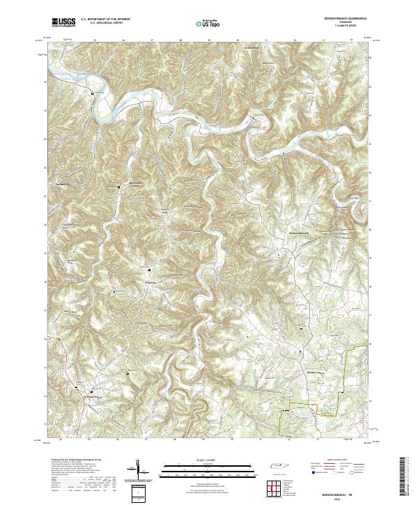
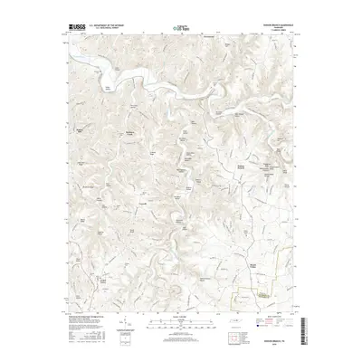
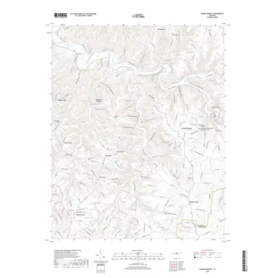
Loading map...2022 Map of Dodson Branch
USGS Topo · Published 2022About this map
The Roaring River carves a winding path through this northern Tennessee landscape, defining the northern border of Putnam County as it meets Jackson County. The terrain is marked by a complex network of hollows and ridges, including Backbone Ridge and the distinctive Seven Knobs. Natural hydrology takes center stage at The Boils and the southern Dry Creek Falls.
Find a feature on this map
166 named features on this map. Tap any name to fly to it.
Don’t see what you’re looking for? This feature index may not catch every label — zoom into the map to look around manually.
Map Details
Date Portrayed2022
Date Published2022
PublisherU.S. Geological Survey
Map TypeTopographic
Scale1:24,000
Physical Dimensions24 x 29 inches
Editions of this 2022 Dodson Branch Map
This is the sole edition of this map. No revisions or reprints were ever made.
Historical Maps of Center Grove Through Time
6 maps found
Featured Locations
Source Details
SourceU.S. Geological Survey
CopyrightPublic Domain