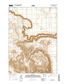
2014 Map of Dog Mountain
USGS Topo · Published 2014About this map
Dog Mountain rises above the high desert floor, dominating a landscape defined by the complex water systems and volcanic geography of Harney County. This 2014 survey illustrates the stark transition from the flat Sage Hen Valley in the north to the dramatic escarpments of Wrights Point and Savage Grade. The area’s ranching and agricultural heritage is evidenced by irrigation works such as the Big Red S Canal and Campbell Reservoir, which divert water from the West Fork Silvies River and Sage Hen Cr. Rural life is centered around the small community of Sunset Valley and several named access points like Island Ranch Ln. From the cattle-path geography near Weaver Spring to the winding course of McGee Slough, this map provides a precise look at how topography and water management dictate movement and settlement in the Oregon interior.
Find a feature on this map
26 named features on this map. Tap any name to fly to it.
Don’t see what you’re looking for? This feature index may not catch every label — zoom into the map to look around manually.
Map Details
Editions of this 2014 Dog Mountain Map
This is the sole edition of this map. No revisions or reprints were ever made.
Other maps of this area

1955 · Burns
USGS Topo · 1:250,000

1958 · Burns
USGS Topo · 1:250,000

1959 · Burns
USGS Topo · 1:250,000

1959 · Harney
USGS Topo · 1:62,500

1959 · Dog Mountain
USGS Topo · 1:62,500

1959 · Lawen
USGS Topo · 1:62,500

1960 · Burns
USGS Topo · 1:62,500

1960 · Burns
USGS Topo · 1:24,000

1975 · Burns
USGS Topo · 1:24,000

1978 · Malheur Lake
USGS Topo · 1:100,000