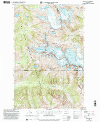
1999 Map of Dome Peak
USGS Topo · Published 2002About this map
Glacier Peak Wilderness defines this high-elevation landscape, where the intersection of Skagit, Snohomish, and Chelan counties meets at the crest of the North Cascades. The map is a remarkable record of late-20th-century glaciology, detailing the expansive South Cascade Glacier, Dome Glacier, and Dana Glacier. These ice fields feed a complex drainage system including the South Fork Cascade River and Sulphur Creek, supporting isolated Gaging Stations used for hydrological monitoring.
Find a feature on this map
41 named features on this map. Tap any name to fly to it.
Don’t see what you’re looking for? This feature index may not catch every label — zoom into the map to look around manually.
Map Details
Editions of this 1999 Dome Peak Map
This is the sole edition of this map. No revisions or reprints were ever made.
Other maps of this area

1899 · Glacier Peak
USGS Topo · 1:125,000

1901 · Glacier Peak
USGS Topo · 1:125,000

1902 · Stehekin
USGS Topo · 1:125,000

1904 · Stehekin
USGS Topo · 1:125,000

1944 · Holden
USGS Topo · 1:62,500

1949 · Holden
USGS Topo · 1:62,500

1950 · Glacier Peak
USGS Topo · 1:62,500

1955 · Concrete
USGS Topo · 1:250,000

1958 · Concrete
USGS Topo · 1:250,000

1962 · Concrete
USGS Topo · 1:250,000