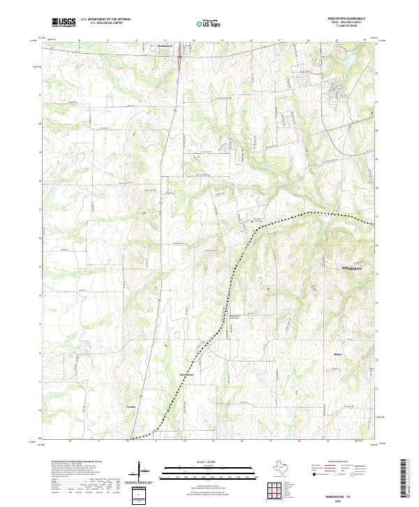
2022 Map of Dorchester
USGS Topo · Published 2022About this map
Dorchester lies at the heart of this Grayson County landscape, situated where the headwaters of the E Fork Trinity River and Choctaw Cr begin to define the local topography. This modern survey captures the rural character and expanding residential developments between larger hubs, featuring the smaller communities of Southmayd to the north and Gunter and Howe to the south. The area is characterized by its numerous small waterways, including Little Elm Cr and Squirrel Cr, which create a complex drainage pattern across the prairie.
Find a feature on this map
83 named features on this map. Tap any name to fly to it.
Don’t see what you’re looking for? This feature index may not catch every label — zoom into the map to look around manually.
Map Details
Editions of this 2022 Dorchester Map
This is the sole edition of this map. No revisions or reprints were ever made.