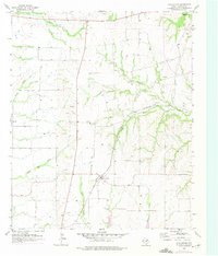
1958 Map of Dorchester
USGS Topo · Published 1975About this map
The small community of Dorchester serves as the central hub in this mid-century look at Grayson County, where the plains of North Texas meet a dense network of seasonal waterways and industry. Two major rail lines dominate the landscape, with the St Louis Southwestern running north-south and the St Louis San Francisco cutting diagonally through the eastern section near Choctaw Branch. This era shows a landscape transitioning between agricultural roots and early industrial extraction, evidenced by the numerous Gravel Pits and an active Oil Well located north of the tracks.
Find a feature on this map
15 named features on this map. Tap any name to fly to it.
Don’t see what you’re looking for? This feature index may not catch every label — zoom into the map to look around manually.
Map Details
Editions of this 1958 Dorchester Map
2 editions found
Other maps of this area

1901 · Denison
USGS Topo · 1:125,000

1954 · Sherman
USGS Topo · 1:250,000

1958 · Dorchester
USGS Topo · 1:24,000

1958 · Sherman NW
USGS Topo · 1:24,000

1958 · Whitesboro
USGS Topo · 1:62,500

1958 · Sherman
USGS Topo · 1:250,000

1958 · Sherman
USGS Topo · 1:62,500

1958 · Sherman
USGS Topo · 1:24,000

1958 · Howe
USGS Topo · 1:24,000

1961 · Gunter
USGS Topo · 1:24,000