
1958 Map of Dorchester
USGS Topo · Published 1959About this map
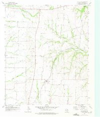
The agricultural landscape of Grayson County is defined by the headwaters of several major North Texas drainages, most notably the East Fork Trinity River and Choctaw Creek. This 1950s survey shows the small community of Dorchester as a central hub, situated near the intersection of the St Louis Southwestern and San Francisco rail lines. The terrain is marked by a network of smaller waterways like Little Elm Creek and Beaver Creek, which carve through the prairie. Smaller named locations such as Norman and Motor appear alongside numerous Gravel Pits, indicating the local extractive industry of the era. The presence of an Oil Well and a Radio Tower further reflect the mid-century modernization of this rural area, providing a clear record of the region's infrastructure before significant later development.
Find a feature on this map
17 named features on this map. Tap any name to fly to it.
Don’t see what you’re looking for? This feature index may not catch every label — zoom into the map to look around manually.
Map Details
Editions of this 1958 Dorchester Map
2 editions found
Other maps of this area

1901 · Denison
USGS Topo · 1:125,000

1954 · Sherman
USGS Topo · 1:250,000

1958 · Sherman NW
USGS Topo · 1:24,000

1958 · Whitesboro
USGS Topo · 1:62,500

1958 · Sherman
USGS Topo · 1:250,000

1958 · Sherman
USGS Topo · 1:62,500

1958 · Sherman
USGS Topo · 1:24,000

1958 · Howe
USGS Topo · 1:24,000

1961 · Gunter
USGS Topo · 1:24,000

1961 · Van Alstyne
USGS Topo · 1:24,000