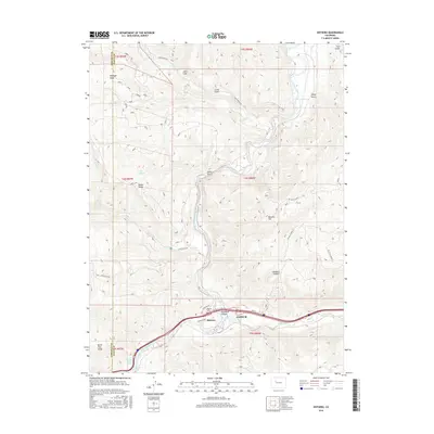
2016 Map of Dotsero
USGS Topo · Published 2016About this map
The Colorado River and Eagle River converge at Dotsero, a geographic focal point where steep canyon walls meet high desert ridges. This 2016 survey details the entry into the formidable Glenwood Canyon, showing the modern infrastructure of HWY 6 and Stephens DR following the same narrow corridors carved by the water. The landscape is defined by its volcanic and thermal activity, most notably at the Dotsero Crater and the nearby Dotsero Warm Springs south of the river junction. Higher elevations are marked by distinctive landmarks such as Onion Ridge, Blowout Hill, and the dramatic Hells Gate. Local history is anchored by the Dotsero Cem, while the surrounding terrain is laced with access routes like Coffee Pot RD and Trl Gulch Road 2, which trace the various gulches and ridges that overlook the river valleys.
Find a feature on this map
36 named features on this map. Tap any name to fly to it.
Don’t see what you’re looking for? This feature index may not catch every label — zoom into the map to look around manually.
Map Details
Editions of this 2016 Dotsero Map
This is the sole edition of this map. No revisions or reprints were ever made.
Other maps of this area

1927 · Glenwood Springs
USGS Topo · 1:125,000

1930 · Glenwood Springs
USGS Topo · 1:125,000

1957 · Leadville
USGS Topo · 1:250,000

1959 · Leadville
USGS Topo · 1:250,000

1960 · Leadville
USGS Topo · 1:250,000

1961 · Cottonwood Pass
USGS Topo · 1:24,000

1961 · Shoshone
USGS Topo · 1:24,000

1962 · Leadville
USGS Topo · 1:250,000

1962 · Gypsum
USGS Topo · 1:24,000
1962 · Suicide Mountain
USGS Topo · 1:24,000