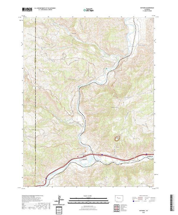
2022 Map of Dotsero
USGS Topo · Published 2022About this map
Dotsero lies at the vital confluence of the Colorado River and the Eagle River, a geographic focal point shaped by ancient volcanic activity and modern transportation. The landscape is defined by the massive Dotsero Crater to the north and the steep, winding entrance to Glenwood Canyon to the west. This 2022 survey details the infrastructure supporting this mountain crossroads, including the Union Pacific railroad corridor and the Dotsero Cem.
Find a feature on this map
68 named features on this map. Tap any name to fly to it.
Don’t see what you’re looking for? This feature index may not catch every label — zoom into the map to look around manually.
Map Details
Editions of this 2022 Dotsero Map
This is the sole edition of this map. No revisions or reprints were ever made.
Other maps of this area

1927 · Glenwood Springs
USGS Topo · 1:125,000

1930 · Glenwood Springs
USGS Topo · 1:125,000

1957 · Leadville
USGS Topo · 1:250,000

1959 · Leadville
USGS Topo · 1:250,000

1960 · Leadville
USGS Topo · 1:250,000

1961 · Cottonwood Pass
USGS Topo · 1:24,000

1961 · Shoshone
USGS Topo · 1:24,000

1962 · Leadville
USGS Topo · 1:250,000

1962 · Gypsum
USGS Topo · 1:24,000
1962 · Suicide Mountain
USGS Topo · 1:24,000