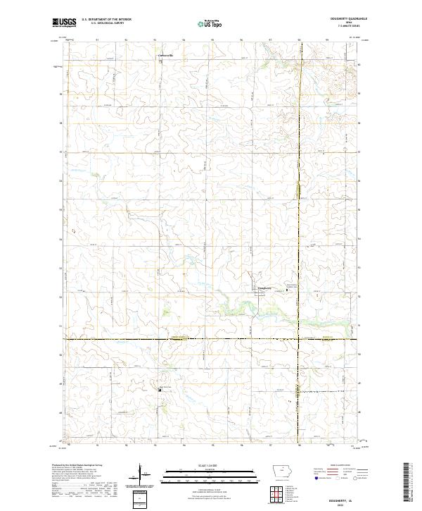
2022 Map of Dougherty
USGS Topo · Published 2022About this map
Dougherty and Cartersville anchor this northern Iowa landscape, where agricultural land use is defined by a dense grid of range lines and county roads. The terrain is intricately carved by several waterways, most notably Coldwater Creek and Boylan Cr, which wind through the township sections. Local genealogy and history are preserved at the Saint Patricks Catholic Cem on the eastern edge of Dougherty and the West Fork Cem to the southwest. This modern survey shows a region where three counties meet — Cerro Gordo, Franklin, and Butler — reflecting the persistence of 19th-century township divisions. The map reveals the meticulous rural infrastructure required to manage this productive farmland, from the drainage patterns of Ackley Cr to the naming of local routes like Zinnia Ave and Warbler Ave.
Find a feature on this map
53 named features on this map. Tap any name to fly to it.
Don’t see what you’re looking for? This feature index may not catch every label — zoom into the map to look around manually.
Map Details
Editions of this 2022 Dougherty Map
This is the sole edition of this map. No revisions or reprints were ever made.
Other maps of this area

1954 · Mason City
USGS Topo · 1:250,000

1954 · Waterloo
USGS Topo · 1:250,000

1955 · Waterloo
USGS Topo · 1:250,000

1957 · Mason City
USGS Topo · 1:250,000

1958 · Mason City
USGS Topo · 1:250,000

1959 · Mason City
USGS Topo · 1:62,500

1959 · Mason City SE
USGS Topo · 1:24,000

1959 · Hanford
USGS Topo · 1:24,000

1971 · Rockford
USGS Topo · 1:24,000

1972 · Dumont North
USGS Topo · 1:24,000