2024 Map of Douglas
USGS Topo · Published 2024About this map
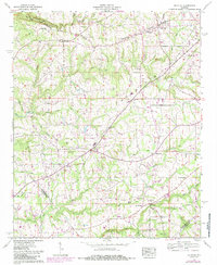
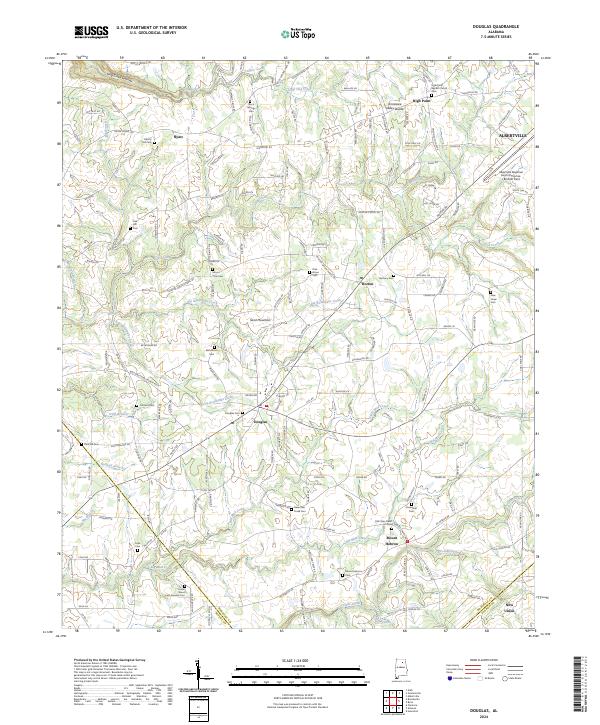
Sand Mountain dominates the center of this Marshall County landscape, where the plateau terrain directs the flow of several watercourses like Big Reedbrake Creek and Big Mud Creek. The settlement of Douglas sits at a central crossroads, surrounded by a high density of rural cemeteries and churches that speak to the long-standing community roots in the region. Notable local landmarks include the Albertville Regional Airport/Thomas J.Brumlik Field in the northeast and the Tennessee Valley-Divide, which runs through the northern sections near High Point. This 2024 survey documents the modern layout of rural roads and residential clusters across the Marshall Co Blount Co and Marshall Co Etowah Co borders, illustrating how the historical agricultural character of the area persists alongside infrastructure like Rock Springs Farm Dr and Oneonta Cutoff Rd.
Find a feature on this map
188 named features on this map. Tap any name to fly to it.
Don’t see what you’re looking for? This feature index may not catch every label — zoom into the map to look around manually.
Map Details
Editions of this 2024 Douglas Map
This is the sole edition of this map. No revisions or reprints were ever made.
Historical Maps of Mount Hebron Through Time
3 maps found