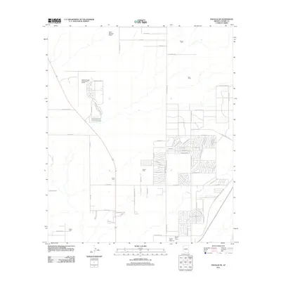
2011 Map of Douglas NE
USGS Topo · Published 2011About this map
The high desert landscape of Cochise County is anchored by the Bisbee-Douglas International Airport and its accompanying landing strips. This region, captured during the early 21st century, exhibits a hybrid character of rural ranching and expanding suburban development. Longstanding family landmarks like Harris Ranch, Watson Ranch, and Stewart Ranch sit alongside organized recreational spaces including the Douglas Golf Course and the Cochise County Fairgrounds. The northeast outskirts of the city show a clear grid of residential streets such as N San Luis Obispo Dr and E Calle Principal, while the northern reaches remain defined by open drainage patterns like Mud Springs Draw. The map documents a period of transition where traditional borderlands ranching meets the formal aviation and civic infrastructure of a growing community.
Find a feature on this map
67 named features on this map. Tap any name to fly to it.
Don’t see what you’re looking for? This feature index may not catch every label — zoom into the map to look around manually.
Map Details
Editions of this 2011 Douglas NE Map
This is the sole edition of this map. No revisions or reprints were ever made.
Other maps of this area

1914 · Douglas
USGS Topo · 1:62,500

1916 · Pearce
USGS Topo · 1:125,000

1916 · Douglas
USGS Topo · 1:125,000

1917 · Chiricahua
USGS Topo · 1:125,000

1919 · Douglas
USGS Topo · 1:125,000

1919 · Perilla
USGS Topo · 1:125,000

1919 · Chiricahua
USGS Topo · 1:125,000

1922 · Swisshelm
USGS Topo · 1:62,500

1925 · Douglas
USGS Topo · 1:62,500

1926 · Pedregosa
USGS Topo · 1:62,500