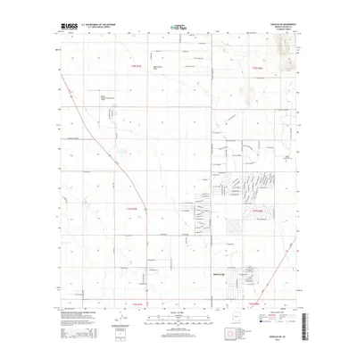
2014 Map of Douglas NE
USGS Topo · Published 2014About this map
The high desert landscape northeast of Douglas is defined by a transitional mix of aviation history and emerging residential development in the mid-2010s. The northern reaches are anchored by the Bisbee Douglas International Airport, a facility with roots in World War II-era training. Moving south toward the international border, the desert scrub gives way to a dense network of residential streets such as E Chula Vista Dr and E Madrone Dr, illustrating the outward expansion of the community. A trace of the area's pioneer heritage remains at the Wells Family Cem, situated near the eastern edge of the survey. The natural drainage of Mud Springs Draw cuts through the western sections, providing a topographic contrast to the long, straight township boundaries and ranch roads like E Old Ranch Rd that organize this corner of Cochise County.
Find a feature on this map
113 named features on this map. Tap any name to fly to it.
Don’t see what you’re looking for? This feature index may not catch every label — zoom into the map to look around manually.
Map Details
Editions of this 2014 Douglas NE Map
This is the sole edition of this map. No revisions or reprints were ever made.
Other maps of this area

1914 · Douglas
USGS Topo · 1:62,500

1916 · Pearce
USGS Topo · 1:125,000

1916 · Douglas
USGS Topo · 1:125,000

1917 · Chiricahua
USGS Topo · 1:125,000

1919 · Douglas
USGS Topo · 1:125,000

1919 · Perilla
USGS Topo · 1:125,000

1919 · Chiricahua
USGS Topo · 1:125,000

1922 · Swisshelm
USGS Topo · 1:62,500

1925 · Douglas
USGS Topo · 1:62,500

1926 · Pedregosa
USGS Topo · 1:62,500