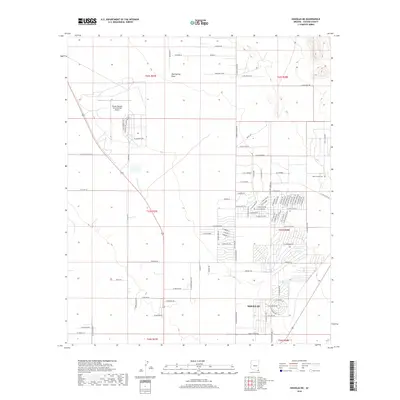
2018 Map of Douglas NE
USGS Topo · Published 2018About this map
Bisbee Douglas International Airport occupies a significant portion of this high-desert landscape in Cochise County, anchoring a network of roads that transition from industrial airport infrastructure to residential grids. To the south, the city of Douglas begins its northern reach with neighborhoods and civic features like the E Golf Course Rd. The terrain is marked by seasonal drainage patterns, most notably Mud Springs Draw, which cuts through the northern sections of the quadrangle. Local history is preserved in the smaller residential pockets and private landholdings, such as the Son Shine Acres subdivision and the Wells Family Cem located on the eastern edge of the survey. The map shows a region defined by its wide open spaces and the structured development radiating from the airport and the city center.
Find a feature on this map
99 named features on this map. Tap any name to fly to it.
Don’t see what you’re looking for? This feature index may not catch every label — zoom into the map to look around manually.
Map Details
Editions of this 2018 Douglas NE Map
This is the sole edition of this map. No revisions or reprints were ever made.
Other maps of this area

1914 · Douglas
USGS Topo · 1:62,500

1916 · Pearce
USGS Topo · 1:125,000

1916 · Douglas
USGS Topo · 1:125,000

1917 · Chiricahua
USGS Topo · 1:125,000

1919 · Douglas
USGS Topo · 1:125,000

1919 · Perilla
USGS Topo · 1:125,000

1919 · Chiricahua
USGS Topo · 1:125,000

1922 · Swisshelm
USGS Topo · 1:62,500

1925 · Douglas
USGS Topo · 1:62,500

1926 · Pedregosa
USGS Topo · 1:62,500