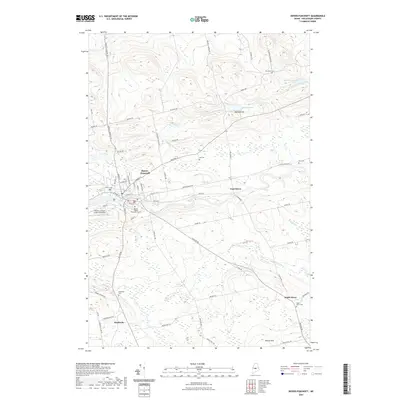
2021 Map of Dover-Foxcroft
USGS Topo · Published 2021About this map
Dover-Foxcroft serves as the primary hub of this Piscataquis County landscape, where the confluence of several rural routes and small streams shapes the local geography. The settlement patterns extend outward to smaller locales like East Dover, South Dover, and the crossroads of Starbirds. This survey is particularly useful for genealogists, as it documents numerous family and community burial grounds including Harriman Cem, Lee Cem, Foss Cem, and the McAllister Cem. The area’s educational and community infrastructure is marked by the Penquis Higher Education Center and the Charles A Chase Jr Memorial Field. To the north, the terrain rises toward Garland Hill near the waters of Garland Pond, while the southern reaches are defined by Norton Hill and Bear Hill. The drainage of Daggett Brook, Alder Stream, and Hall Brook underscores the wooded, riparian character typical of central Maine's interior.
Find a feature on this map
71 named features on this map. Tap any name to fly to it.
Don’t see what you’re looking for? This feature index may not catch every label — zoom into the map to look around manually.
Map Details
Editions of this 2021 Dover-Foxcroft Map
This is the sole edition of this map. No revisions or reprints were ever made.
Other maps of this area

1932 · Dover-Foxcroft
USGS Topo · 1:48,000

1933 · Guilford
USGS Topo · 1:62,500

1935 · Dover-Foxcroft
USGS Topo · 1:62,500

1937 · Guilford
USGS Topo · 1:62,500

1940 · Sebec
USGS Topo · 1:48,000

1943 · Sebec
USGS Topo · 1:62,500

1950 · Sebec Lake
USGS Topo · 1:62,500

1954 · Millinocket
USGS Topo · 1:250,000

1958 · Millinocket
USGS Topo · 1:250,000

1960 · Millinocket
USGS Topo · 1:250,000