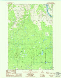
1986 Map of Doyle Ridge
USGS Topo · Published 1986About this map
The St John River defines the international boundary between Maine and New Brunswick on this mid-1980s survey of northern Aroostook County. The landscape is characterized by its organized plantations, including Cyr Plantation and Caswell Plantation, alongside the township of Hamlin. This region is a complex network of waterways and wetlands, such as Orchard Bog and Hammond Brook Lake, which feed the many branches of Black Brook. The settlement of Bellefleur sits along the river's edge, while the interior is dominated by the prominence of Doyle Ridge. A notable jurisdictional feature is the U S Military Res located in the southern portion of the quadrangle. The map captures the remote timberlands and watershed patterns essential to the northern Maine border economy before modern development further altered the landscape.
Find a feature on this map
24 named features on this map. Tap any name to fly to it.
Don’t see what you’re looking for? This feature index may not catch every label — zoom into the map to look around manually.
Map Details
Editions of this 1986 Doyle Ridge Map
This is the sole edition of this map. No revisions or reprints were ever made.
Other maps of this area

1921 · Van Buren
USGS Topo · 1:250,000

1927 · Stockholm
USGS Topo · 1:48,000

1929 · Caribou
USGS Topo · 1:48,000

1930 · Fort Fairfield
USGS Topo · 1:48,000

1931 · Van Buren
USGS Topo · 1:48,000

1931 · Stockholm
USGS Topo · 1:62,500

1932 · Caribou
USGS Topo · 1:62,500

1933 · Fort Fairfield
USGS Topo · 1:62,500

1934 · Van Buren
USGS Topo · 1:62,500

1951 · Van Buren
USGS Topo · 1:62,500