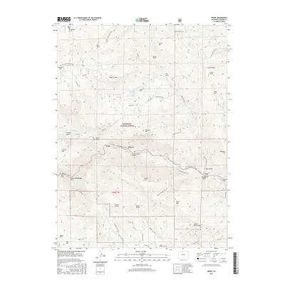
2016 Map of Drake
USGS Topo · Published 2016About this map
The settlement of Drake sits at the confluence of the N Fork Big Thompson River and the main channel of the Big Thompson River, serving as a focal point for the mountain communities of Waltonia and Midway. This 2016 survey highlights the intricate topography of the Roosevelt National Forest, where steep drainages like Galuchie Gulch and Bobcat Gulch define the high-altitude landscape. The map captures the engineering of the era through the Idylwilde Reservoir and Cedar Springs Reservoir, which manage the flow through the narrow Big Thompson Canyon. Notable peaks such as Palisade Mtn and Sheep Mtn overlook a network of backcountry routes, including the Round Mountain Trail and Storm Mountain Access. Local history is preserved in named landmarks like Saddle Notch and Pole Hill, reflecting the early nomenclature of Larimer County’s mountain passes and summits.
Find a feature on this map
61 named features on this map. Tap any name to fly to it.
Don’t see what you’re looking for? This feature index may not catch every label — zoom into the map to look around manually.
Map Details
Editions of this 2016 Drake Map
This is the sole edition of this map. No revisions or reprints were ever made.
Other maps of this area

1905 · Mount Olympus
USGS Topo · 1:62,500

1906 · Loveland
USGS Topo · 1:62,500

1906 · Fort Collins
USGS Topo · 1:62,500

1907 · Mount Olympus
USGS Topo · 1:62,500

1907 · Livermore
USGS Topo · 1:125,000

1908 · Loveland
USGS Topo · 1:62,500

1908 · Fort Collins
USGS Topo · 1:62,500

1909 · Livermore
USGS Topo · 1:125,000

1954 · Greeley
USGS Topo · 1:250,000

1957 · Greeley
USGS Topo · 1:250,000