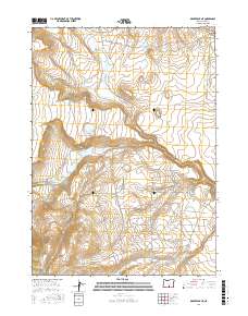
2017 Map of Drake Peak NE
USGS Topo · Published 2017About this map
Luce Reservoir and the North Coyote Hills Reservoir anchor this high-desert landscape in Lake County, defining a region where water management is central to the terrain. A sophisticated network of irrigation infrastructure is visible, including the extensive Fitzgerald Ditches, Luce Ditch, Priday Ditch, and Allen Ditch. These man-made channels diverge from natural watercourses like Honey Cr and Snyder Cr, illustrating the historical effort to divert seasonal runoff for agricultural or ranching use. The drainage patterns of Juniper Spring Draw and Colvin Cr in the north transition into the southern basins of Fort Cr and McDowell Cr, showing the complex hydrologic character of the Oregon outback. The map preserves the exact alignment of these historical water rights and land divisions within the Public Land Survey System.
Find a feature on this map
23 named features on this map. Tap any name to fly to it.
Don’t see what you’re looking for? This feature index may not catch every label — zoom into the map to look around manually.
Map Details
Editions of this 2017 Drake Peak NE Map
This is the sole edition of this map. No revisions or reprints were ever made.
Other maps of this area

1955 · Klamath Falls
USGS Topo · 1:250,000

1955 · Adel
USGS Topo · 1:250,000

1957 · Adel
USGS Topo · 1:250,000

1958 · Klamath Falls
USGS Topo · 1:250,000

1958 · Adel
USGS Topo · 1:250,000

1962 · Adel
USGS Topo · 1:250,000

1967 · Plush
USGS Topo · 1:24,000

1967 · Rabbit Hills SW
USGS Topo · 1:24,000

1967 · Priday Reservoir
USGS Topo · 1:24,000

1968 · Crook Peak
USGS Topo · 1:24,000