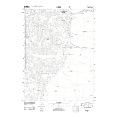
2011 Map of Draper
USGS Topo · Published 2011About this map
Cottonwood Heights, Sandy City, and Draper occupy a landscape where the dense residential expansion of the Salt Lake Valley meets the steep rise of the Wasatch Range. The 2011 topography reveals a highly developed suburban grid interrupted by significant genealogical landmarks, including the historic Union Fort Pioneer Cemetery and the Larkin Sunset Gardens. To the east, the map detail shifts abruptly from street networks to the wilderness of the national forest, marked by deep incisions like Ferguson Canyon and Little Cottonwood Canyon. Of particular note is the Latter Day Saints Church Records Storage Area situated near Granite Spring, reflecting the specific cultural infrastructure of the region. The drainage patterns of Big Cottonwood Creek and Willow Creek are clearly traced as they emerge from the mountains to navigate the valley floor, while features like Lower Bells Canyon Reservoir and Mellen Sand Spur illustrate the ongoing management of water and mineral resources in this mountain-fringe environment.
Find a feature on this map
53 named features on this map. Tap any name to fly to it.
Don’t see what you’re looking for? This feature index may not catch every label — zoom into the map to look around manually.
Map Details
Editions of this 2011 Draper Map
This is the sole edition of this map. No revisions or reprints were ever made.
Other maps of this area

1885 · Salt Lake
USGS Topo · 1:250,000

1925 · Ft. Douglas
USGS Topo · 1:125,000

1928 · Ft. Douglas
USGS Topo · 1:125,000

1948 · Timpanogos Cave
USGS Topo · 1:24,000

1948 · Orem
USGS Topo · 1:62,500

1950 · Timpanogos Cave
USGS Topo · 1:24,000

1951 · Jordan Narrows
USGS Topo · 1:24,000

1951 · Lehi
USGS Topo · 1:24,000

1951 · Salt Lake City South
USGS Topo · 1:24,000

1951 · Midvale
USGS Topo · 1:24,000