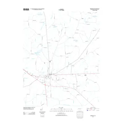
2013 Map of Dresden
USGS Topo · Published 2013About this map
Dresden serves as the central hub of this West Tennessee landscape, where a dense network of roads like Winstead Rd and Rabbit Ranch Rd radiate into the surrounding agricultural terrain. The region is characterized by an extensive system of managed water resources, including the Middle Fork Obion River and a series of numbered reservoirs such as Cypress Creek Lake Number Twelve and Cypress Creek Lake Number Ten. Small settlements and named locales like Red Hill and West Union dot the countryside, connected by secondary routes that trace the area's local geography.
Find a feature on this map
123 named features on this map. Tap any name to fly to it.
Don’t see what you’re looking for? This feature index may not catch every label — zoom into the map to look around manually.
Map Details
Editions of this 2013 Dresden Map
This is the sole edition of this map. No revisions or reprints were ever made.
Other maps of this area

1950 · Martin
USGS Topo · 1:24,000

1952 · Dresden
USGS Topo · 1:24,000

1954 · Greenfield
USGS Topo · 1:24,000

1956 · Mc Connell
USGS Topo · 1:24,000

1956 · Latham
USGS Topo · 1:24,000
1956 · Palmersville
USGS Topo · 1:24,000

1956 · Dyersburg
USGS Topo · 1:250,000

1957 · Como
USGS Topo · 1:24,000

1967 · Pillowville
USGS Topo · 1:24,000
1967 · Mc Kenzie
USGS Topo · 1:24,000