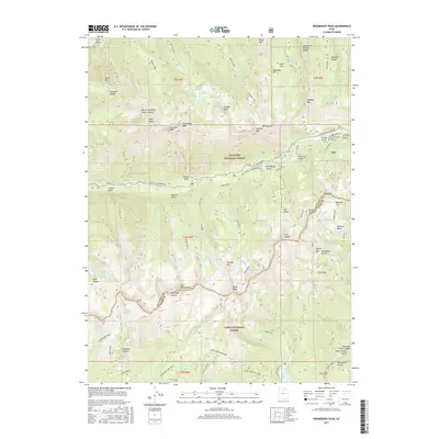
2017 Map of Dromedary Peak
USGS Topo · Published 2017About this map
Alta sits as a central hub within the high-elevation terrain of the Wasatch National Forest and Uinta National Forest. This 2017 survey shows the modern recreational footprint of the region, including the White Pine - Snowbird Link and developed areas like Albion Meadows. The town's historical roots are preserved at the Alta City Cem, located near Collins Gulch.
Find a feature on this map
78 named features on this map. Tap any name to fly to it.
Don’t see what you’re looking for? This feature index may not catch every label — zoom into the map to look around manually.
Map Details
Editions of this 2017 Dromedary Peak Map
This is the sole edition of this map. No revisions or reprints were ever made.
Other maps of this area

1885 · Salt Lake
USGS Topo · 1:250,000

1925 · Ft. Douglas
USGS Topo · 1:125,000

1928 · Ft. Douglas
USGS Topo · 1:125,000

1948 · Timpanogos Cave
USGS Topo · 1:24,000

1948 · Orem
USGS Topo · 1:62,500

1948 · Aspen Grove
USGS Topo · 1:24,000

1950 · Aspen Grove
USGS Topo · 1:24,000

1950 · Timpanogos Cave
USGS Topo · 1:24,000

1951 · Lehi
USGS Topo · 1:24,000

1952 · Sugar House
USGS Topo · 1:24,000