2022 Map of Drummond
USGS Topo · Published 2022About this map
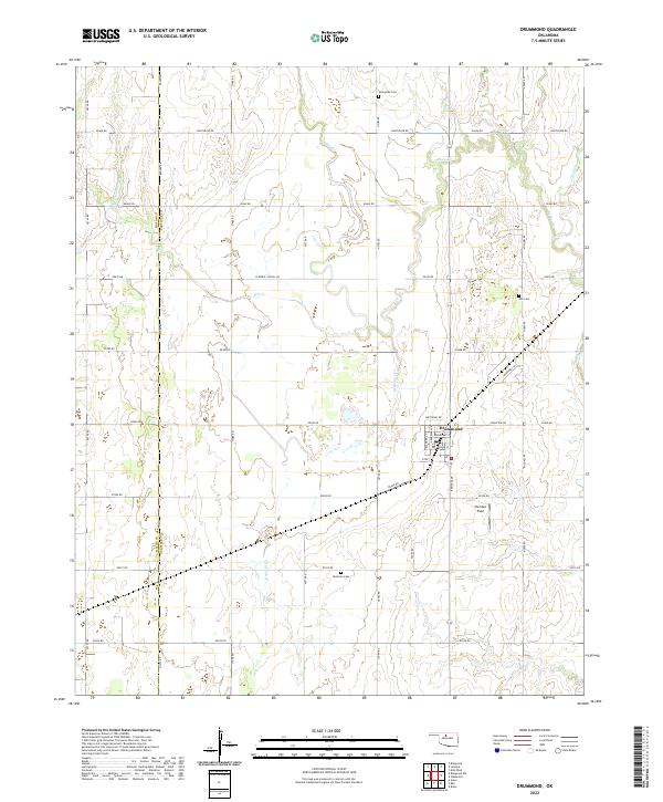
Drummond serves as the central hub for this portion of the Oklahoma plains, situated at the intersection of a grid-iron road network and several seasonal waterways. The township layout is clearly defined by streets such as Oklahoma St, Broadway St, and Kansas Ave, reflecting a structured approach to prairie settlement. Outside the town limits, the landscape is etched by the meandering paths of Turkey Cr, Dry Salt Cr, and Clear Cr, which contrast with the rigid sections of the Public Land Survey System. For those tracing local heritage, the map identifies three distinct burial sites: Sunnyside Cem to the north, Imo Cem to the northeast, and Delnorte Cem to the south. The presence of Sheriden Field and roads like W Wheat Capital Rd hint at the area's agricultural and civil aviation history.
Find a feature on this map
39 named features on this map. Tap any name to fly to it.
Don’t see what you’re looking for? This feature index may not catch every label — zoom into the map to look around manually.
Map Details
Editions of this 2022 Drummond Map
This is the sole edition of this map. No revisions or reprints were ever made.