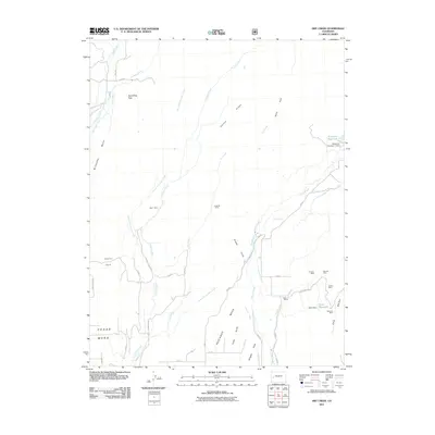
2011 Map of Dry Creek
USGS Topo · Published 2011About this map
Agricultural and extractive activity defines this high-altitude landscape in Delta County, where complex irrigation systems support the local economy. The terrain transitions from Cedar Mesa and Oak Mesa down through deep drainages like Stingley Gulch and Grassy Gulch. Water management is central to the area's development, evidenced by the extensive network of ditches and canals such as the Overland Canal, Cedar Mesa Ditch, and Cow Creek Ditch. These systems divert water from Leroux Creek and Currant Creek to support operations like the Seven X Ranch.
Find a feature on this map
56 named features on this map. Tap any name to fly to it.
Don’t see what you’re looking for? This feature index may not catch every label — zoom into the map to look around manually.
Map Details
Editions of this 2011 Dry Creek Map
This is the sole edition of this map. No revisions or reprints were ever made.
Other maps of this area

1955 · Grand Mesa
USGS Topo · 1:24,000

1955 · Lazear
USGS Topo · 1:24,000

1956 · Montrose
USGS Topo · 1:250,000

1957 · Leadville
USGS Topo · 1:250,000

1959 · Leadville
USGS Topo · 1:250,000

1959 · Montrose
USGS Topo · 1:250,000

1960 · Leadville
USGS Topo · 1:250,000

1960 · Montrose
USGS Topo · 1:250,000

1960 · Leon Peak
USGS Topo · 1:24,000

1961 · Chalk Mountain
USGS Topo · 1:24,000