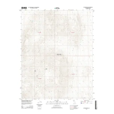
2015 Map of Dry Mountain
USGS Topo · Published 2015About this map
Death Valley National Park encompasses the high desert terrain shown in this 2015 topographic survey of Inyo County. The landscape is dominated by the steep elevations of the Last Chance Range, where the summit of Dry Mtn serves as a primary landmark. This portion of the Mojave Desert is characterized by extreme relief and sparse water sources, such as the isolated Marble Bath located in the northwestern section of the quadrangle. The map details the complex Township and Range boundaries, including t11s r40e and t12s r41e, which provide essential geographic indexing for land management within the park's protected borders. The absence of developed roads or settlements highlights the wilderness character of this high-elevation desert environment.
Find a feature on this map
9 named features on this map. Tap any name to fly to it.
Don’t see what you’re looking for? This feature index may not catch every label — zoom into the map to look around manually.
Map Details
Editions of this 2015 Dry Mountain Map
This is the sole edition of this map. No revisions or reprints were ever made.
Other maps of this area

1908 · Lida
USGS Topo · 1:250,000

1908 · Ballarat
USGS Topo · 1:250,000

1913 · Lida
USGS Topo · 1:250,000

1913 · Ballarat
USGS Topo · 1:250,000

1948 · Death Valley
USGS Topo · 1:250,000

1954 · Death Valley
USGS Topo · 1:250,000

1954 · Goldfield
USGS Topo · 1:250,000

1955 · Goldfield
USGS Topo · 1:250,000

1956 · Death Valley
USGS Topo · 1:250,000

1957 · Death Valley
USGS Topo · 1:250,000