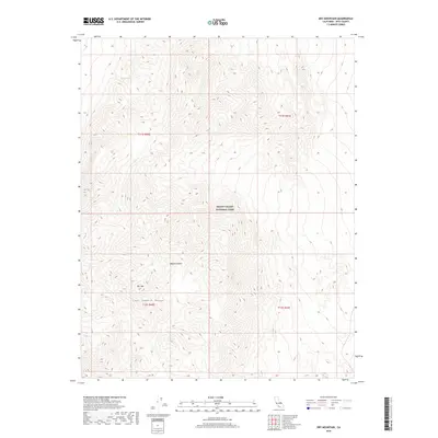
2018 Map of Dry Mountain
USGS Topo · Published 2018About this map
The high ridges of the Last Chance Range dominate this 2018 survey of the northern reaches of Death Valley National Park. In this stark landscape within the Mojave Desert, the elevation reaches its peak at Dry Mtn, a prominent summit surrounded by a complex network of canyons and desert washes. The map depicts a territory largely defined by its topography and the absence of permanent human settlement, with the unique geographical feature Marble Bath noted in the northwestern quadrant. The document serves as a precise record of the public land survey system, illustrating the boundaries of township and range lines such as t11s r40e and t12s r41e across this protected wilderness area in Inyo County.
Find a feature on this map
9 named features on this map. Tap any name to fly to it.
Don’t see what you’re looking for? This feature index may not catch every label — zoom into the map to look around manually.
Map Details
Editions of this 2018 Dry Mountain Map
This is the sole edition of this map. No revisions or reprints were ever made.
Other maps of this area

1908 · Lida
USGS Topo · 1:250,000

1908 · Ballarat
USGS Topo · 1:250,000

1913 · Lida
USGS Topo · 1:250,000

1913 · Ballarat
USGS Topo · 1:250,000

1948 · Death Valley
USGS Topo · 1:250,000

1954 · Death Valley
USGS Topo · 1:250,000

1954 · Goldfield
USGS Topo · 1:250,000

1955 · Goldfield
USGS Topo · 1:250,000

1956 · Death Valley
USGS Topo · 1:250,000

1957 · Death Valley
USGS Topo · 1:250,000