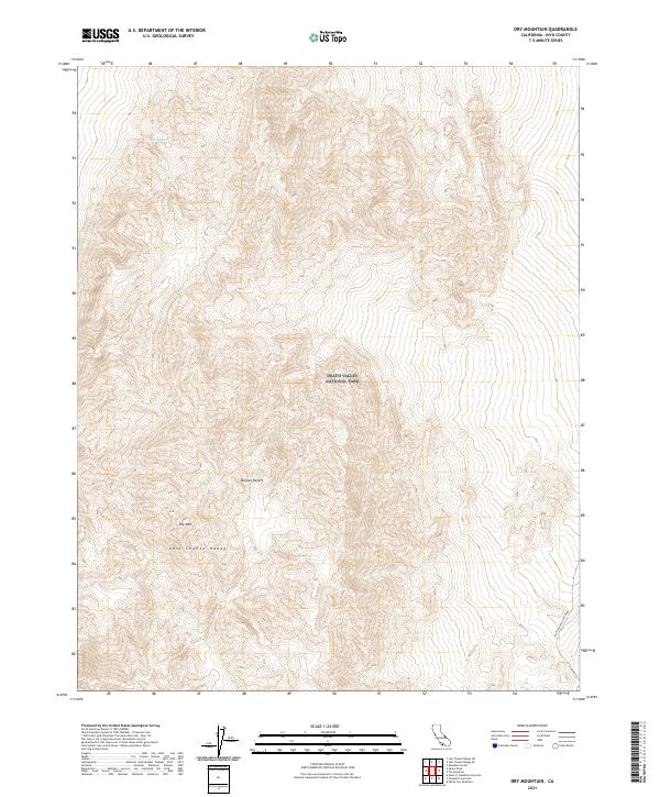
2021 Map of Dry Mountain
USGS Topo · Published 2021About this map
The Mojave Desert terrain dominates this portion of Death Valley National Park, where dramatic elevation changes define the landscape. Centered on the high peaks of Dry Mtn, the map traces the northern reaches of the Last Chance Range as it drops toward the desert floor. In this arid environment, smaller features like the Marble Bath stand out as rare named landmarks in an otherwise stark topography. On the eastern edge of the quadrangle, Racetrack Valley Road provides the primary corridor for movement through the valley below the mountains. This 2021 survey utilizes high-resolution data to document the complex landforms and Public Land Survey System boundaries, such as t12s r40e, that remain vital for park management and geographic orientation in this remote section of Inyo County.
Find a feature on this map
10 named features on this map. Tap any name to fly to it.
Don’t see what you’re looking for? This feature index may not catch every label — zoom into the map to look around manually.
Map Details
Editions of this 2021 Dry Mountain Map
This is the sole edition of this map. No revisions or reprints were ever made.
Other maps of this area

1908 · Lida
USGS Topo · 1:250,000

1908 · Ballarat
USGS Topo · 1:250,000

1913 · Lida
USGS Topo · 1:250,000

1913 · Ballarat
USGS Topo · 1:250,000

1948 · Death Valley
USGS Topo · 1:250,000

1954 · Death Valley
USGS Topo · 1:250,000

1954 · Goldfield
USGS Topo · 1:250,000

1955 · Goldfield
USGS Topo · 1:250,000

1956 · Death Valley
USGS Topo · 1:250,000

1957 · Death Valley
USGS Topo · 1:250,000