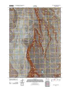
2011 Map of Dry Valley Rim
USGS Topo · Published 2011About this map
Boyce Ranch stands as a primary point of human activity in this sparsely developed landscape within Harney County. The area is defined by the significant geographic rise of the Dry Valley Rim, which overlooks the expanse of Dry Valley. This 2011 survey reveals a landscape dependent on a handful of unpaved routes, such as Dry Valley Rd and E Dry Valley Rd, to navigate the high desert terrain. Water sources are rare in this environment, with Juniper Creek providing one of the few named hydrological features in the region. The map captures the intersection of ranching infrastructure and the natural topography of southeastern Oregon at the start of the 21st century.
Find a feature on this map
6 named features on this map. Tap any name to fly to it.
Don’t see what you’re looking for? This feature index may not catch every label — zoom into the map to look around manually.
Map Details
Editions of this 2011 Dry Valley Rim Map
This is the sole edition of this map. No revisions or reprints were ever made.
Other maps of this area

1955 · Burns
USGS Topo · 1:250,000

1955 · Adel
USGS Topo · 1:250,000

1957 · Adel
USGS Topo · 1:250,000

1958 · Burns
USGS Topo · 1:250,000

1958 · Adel
USGS Topo · 1:250,000

1959 · Burns
USGS Topo · 1:250,000

1962 · Adel
USGS Topo · 1:250,000

1971 · Rock Camp Draw
USGS Topo · 1:24,000
1971 · Red Bank Lakes
USGS Topo · 1:24,000
1984 · Turpin Knoll
USGS Topo · 1:24,000