
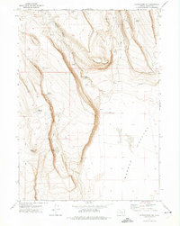
1971 Map of Rock Camp Draw
USGS Topo · Published 1974About this map
Juniper Ridge and the high basins of Harney County define this 1971 topographical study, capturing a high-desert landscape before modern development altered its primitive access. This remote pocket of Oregon is characterized by a network of seasonal water sources and isolated homesteads, including Hempy Cabin in the north and Anderson Cabin to the south. The terrain is deeply incised by drainages such as Rock Camp Draw and Open Draw, while numerous small water bodies like Monahan Lake and Old Jims Lake dot the ridges. The label for Mule Tit near Mule Spring serves as a distinctive local landmark, reflecting the vernacular naming conventions of the era's ranching or surveying crews. This map provides a clear record of the early 1970s land use, where movement was dictated by the Jeep Trail systems winding through Mule Springs Valley and across the high plateaus.
Find a feature on this map
21 named features on this map. Tap any name to fly to it.
Don’t see what you’re looking for? This feature index may not catch every label — zoom into the map to look around manually.
Map Details
Editions of this 1971 Rock Camp Draw Map
This is the sole edition of this map. No revisions or reprints were ever made.
Other maps of this area

1955 · Burns
USGS Topo · 1:250,000

1955 · Adel
USGS Topo · 1:250,000

1957 · Adel
USGS Topo · 1:250,000

1958 · Burns
USGS Topo · 1:250,000

1958 · Adel
USGS Topo · 1:250,000

1959 · Burns
USGS Topo · 1:250,000

1962 · Adel
USGS Topo · 1:250,000

1971 · Steamboat Point
USGS Topo · 1:24,000

1971 · Orejana Canyon
USGS Topo · 1:24,000
1971 · Corporation Rim
USGS Topo · 1:24,000