
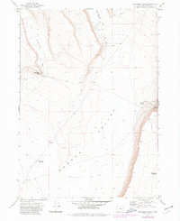
1971 Map of Steamboat Point
USGS Topo · Published 1974About this map
Warner Valley dominates this high-desert landscape in Harney County, where the topography transitions from the broad basin floor to the steep verticality of Steamboat Point. Surveyed in 1969 and field-checked in 1971, the map documents a remote region of southeast Oregon defined by its drainage and water management. High plateaus are carved by Kit Canyon and Orijana Canyon, while the valley floor below is marked by essential livestock water sources like Drift Fence Waterhole and Middle Lake Waterhole. The sparse infrastructure of the early 1970s is limited to a network of unimproved roads and several Jeep Trails, highlighting the isolation of Mule Springs Valley and the surrounding rimrock. This record of the land captures the character of Oregon's cattle country before modern developments altered these traditional grazing territories.
Find a feature on this map
11 named features on this map. Tap any name to fly to it.
Don’t see what you’re looking for? This feature index may not catch every label — zoom into the map to look around manually.
Map Details
Editions of this 1971 Steamboat Point Map
2 editions found
Other maps of this area

1955 · Adel
USGS Topo · 1:250,000

1957 · Adel
USGS Topo · 1:250,000

1958 · Adel
USGS Topo · 1:250,000

1962 · Adel
USGS Topo · 1:250,000

1966 · Bluejoint Lake East
USGS Topo · 1:24,000

1967 · Bluejoint Lake West
USGS Topo · 1:24,000

1971 · Orejana Canyon
USGS Topo · 1:24,000

1971 · Rock Camp Draw
USGS Topo · 1:24,000
1971 · Sixmile Draw
USGS Topo · 1:24,000
1971 · Corporation Rim
USGS Topo · 1:24,000