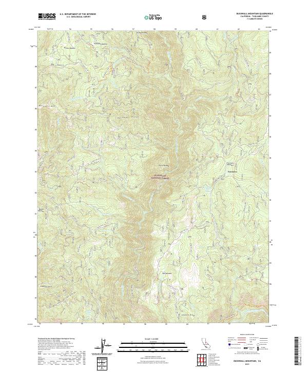
2021 Map of Duckwall Mountain
USGS Topo · Published 2021About this map
Stanislaus National Forest landscape is defined by the steep elevation changes between the Clavey River and the high ridges of the central Sierra Nevada. The map highlights a series of seasonal meadows and water sources essential to the region's historic grazing and mining activities, including Willow Meadow, Thompson Meadow, and Bull Meadow. Named points like Duckwall Mtn and Thompson Peak tower over a network of Forest Service routes that provide access to the interior. Traces of human presence and history are found in labels for Femmons and the Andresen Mine Trl near the southern edge. The lower boundary is marked by the Tuolumne Wild and Scenic River, where the terrain drops sharply at Butcher Knife Ridge and Jawbone Ridge.
Find a feature on this map
63 named features on this map. Tap any name to fly to it.
Don’t see what you’re looking for? This feature index may not catch every label — zoom into the map to look around manually.
Map Details
Editions of this 2021 Duckwall Mountain Map
This is the sole edition of this map. No revisions or reprints were ever made.
Other maps of this area

1891 · Big Trees
USGS Topo · 1:125,000

1893 · Sonora
USGS Topo · 1:125,000

1894 · Big Trees
USGS Topo · 1:125,000

1896 · Dardanelles
USGS Topo · 1:125,000

1896 · Sonora
USGS Topo · 1:125,000

1897 · Sonora
USGS Topo · 1:125,000

1897 · Big Trees
USGS Topo · 1:125,000

1897 · Yosemite
USGS Topo · 1:125,000

1898 · Dardanelles
USGS Topo · 1:125,000

1898 · Sonora
USGS Topo · 1:125,000