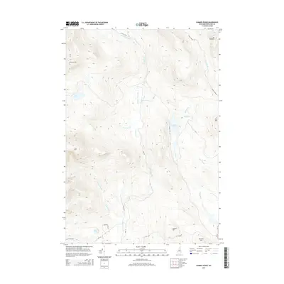
2015 Map of Dummer Ponds
USGS Topo · Published 2015About this map
Dummer Ponds and the surrounding drainage basins of Phillips Brook characterize this 2015 survey of the New Hampshire backcountry. The landscape is defined by a series of prominent peaks and hills, including Mt Patience, Whitcomb Mtn, and Long Mtn, which frame the watershed for several named waterways. Small, secluded water bodies like Trio Ponds, Mud Pond, and Pike Pond are tucked into the high-elevation terrain. A network of logging and local access roads, such as Phillips Brook Rd, Dummer Pond Rd, and Paris Rd, provides the primary infrastructure through the timberlands. While mostly unpopulated, the southern reaches show the early climbs of Dummer Hill and Bickford Hill, with RT 16 clipping the southeastern corner near the edges of established mountain settlements.
Find a feature on this map
29 named features on this map. Tap any name to fly to it.
Don’t see what you’re looking for? This feature index may not catch every label — zoom into the map to look around manually.
Map Details
Editions of this 2015 Dummer Ponds Map
This is the sole edition of this map. No revisions or reprints were ever made.
Other maps of this area

1930 · Milan
USGS Topo · 1:62,500

1930 · Percy
USGS Topo · 1:62,500

1930 · Dixville
USGS Topo · 1:62,500

1930 · Errol
USGS Topo · 1:62,500

1933 · Dixville
USGS Topo · 1:62,500

1933 · Milan
USGS Topo · 1:62,500

1934 · Percy
USGS Topo · 1:62,500

1934 · Dixville
USGS Topo · 1:62,500

1934 · Errol
USGS Topo · 1:62,500

1934 · Milan
USGS Topo · 1:62,500