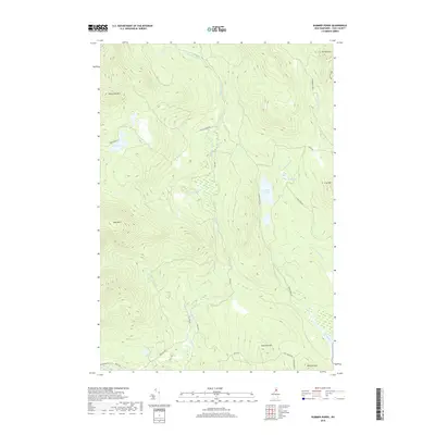
2018 Map of Dummer Ponds
USGS Topo · Published 2018About this map
Dummer Ponds and the surrounding woodlands of Coos County define this landscape during the late 2010s. The area is characterized by a dense network of logging roads and trails, such as Phillips Brook Rd and Dummer Pond Rd, which navigate the high terrain of Whitcomb Mtn and Long Mtn. These peaks overlook a series of isolated water bodies, including Trio Ponds and Mud Pond, connected by drainage systems like Jodrie Brook and Newell Brook. The presence of numerous family-named landmarks, such as Bickford Hill and Dummer Hill, suggests a landscape shaped by historical landholdings and seasonal recreational use. The lack of concentrated settlements highlights the region's character as a timber and conservation tract, where traditional access routes like Paris Rd and Sullivan Rd remain the primary means of traversing the high country between the peaks of Mt Patience and Cow Mtn.
Find a feature on this map
31 named features on this map. Tap any name to fly to it.
Don’t see what you’re looking for? This feature index may not catch every label — zoom into the map to look around manually.
Map Details
Editions of this 2018 Dummer Ponds Map
This is the sole edition of this map. No revisions or reprints were ever made.
Other maps of this area

1930 · Milan
USGS Topo · 1:62,500

1930 · Percy
USGS Topo · 1:62,500

1930 · Dixville
USGS Topo · 1:62,500

1930 · Errol
USGS Topo · 1:62,500

1933 · Dixville
USGS Topo · 1:62,500

1933 · Milan
USGS Topo · 1:62,500

1934 · Percy
USGS Topo · 1:62,500

1934 · Dixville
USGS Topo · 1:62,500

1934 · Errol
USGS Topo · 1:62,500

1934 · Milan
USGS Topo · 1:62,500