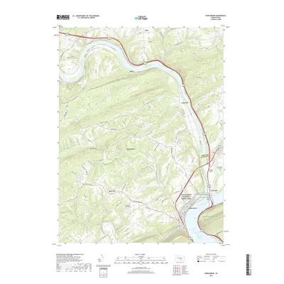
2019 Map of Duncannon
USGS Topo · Published 2019About this map
The Susquehanna River and Juniata River converge in this 2019 survey of Perry County, Pennsylvania, where the Appalachian National Scenic Trail winds through the hills and across the Clarks Ferry Bridge. The borough of Duncannon sits at the heart of this river junction, flanked by the Norfolk Southern rail line and the waters of Shermans Creek. The terrain is defined by the sharp bend of The Narrows and the prominent Chestnut Hill, illustrating the complex valley-and-ridge landscape that has historically shaped transportation routes in the region. Smaller communities like Montebello, Rose Glen, and Acker are linked by a network of winding roads such as New Bloomfield Rd and State Rte 849. To the east, Duncan Island sits in the middle of the Susquehanna, near the Garman Cem on Haldeman Island, providing a detailed look at the island geography and its local landmarks.
Find a feature on this map
93 named features on this map. Tap any name to fly to it.
Don’t see what you’re looking for? This feature index may not catch every label — zoom into the map to look around manually.
Map Details
Editions of this 2019 Duncannon Map
This is the sole edition of this map. No revisions or reprints were ever made.
Other maps of this area

1892 · Harrisburg
USGS Topo · 1:62,500

1893 · Millersburg
USGS Topo · 1:62,500

1899 · Harrisburg
USGS Topo · 1:62,500

1907 · New Bloomfield
USGS Topo · 1:62,500

1907 · Millerstown
USGS Topo · 1:62,500

1924 · Harrisburg
USGS Topo · 1:62,500

1943 · Millerstown
USGS Topo · 1:62,500

1943 · Millersburg
USGS Topo · 1:62,500

1943 · Harrisburg
USGS Topo · 1:62,500

1943 · New Bloomfield
USGS Topo · 1:62,500
Featured Places
- Wheatfield Township, PA
- Reed Township, PA
- Watts Township, PA
- Centre Township, PA
- Montebello, Wheatfield Township