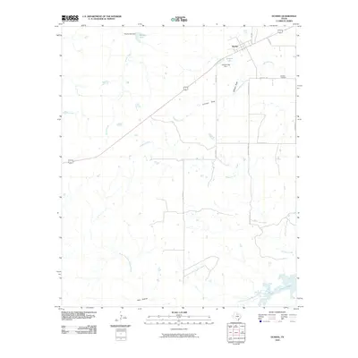
2010 Map of Dundee
USGS Topo · Published 2010About this map
Dundee anchors this section of Archer County, situated at a highway junction amidst a landscape defined by ranch roads and seasonal watercourses. The local infrastructure reflects a reliance on managed water sources, evident in features like Brushy Tank and Gilmore Lake, which is contained by the Gilmore Lake Dam. To the south, the terrain descends toward the North Fork Little Wichita River and the northern reaches of Lake Kickapoo, showing how the geography shifts from open upland draws to more substantial riparian systems.
Find a feature on this map
22 named features on this map. Tap any name to fly to it.
Don’t see what you’re looking for? This feature index may not catch every label — zoom into the map to look around manually.
Map Details
Editions of this 2010 Dundee Map
This is the sole edition of this map. No revisions or reprints were ever made.
Other maps of this area

1932 · Dundee
USGS Topo · 1:62,500

1954 · Wichita Falls
USGS Topo · 1:250,000

1958 · Wichita Falls
USGS Topo · 1:250,000

1963 · Dundee
USGS Topo · 1:24,000

1963 · Dundee SW
USGS Topo · 1:24,000

1964 · Dundee SE
USGS Topo · 1:24,000
1966 · Mankins
USGS Topo · 1:24,000

1966 · Franklin Bend
USGS Topo · 1:24,000

1966 · Fulda
USGS Topo · 1:24,000
1966 · Lake Diversion
USGS Topo · 1:24,000