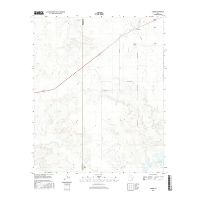
2016 Map of Dundee
USGS Topo · Published 2016About this map
Dundee sits at the intersection of local history and the expansive landscape of North Texas, where the boundaries of Baylor and Archer counties meet. This survey documents a ranching and water-driven geography, defined by the winding course of the N Fork Little Wichita River and the northern reaches of Lake Kickapoo. The presence of the Dundee Cem and family-named roads like N Parkey Ranch Rd speaks to generations of settlement in this prairie environment. A complex drainage system, including Holliday Cr, Slippery Cr, and Brushy Cr, crisscrosses the terrain, feeding into reservoirs such as Gilmore Lake and Brushy Tank. The settlement at Red Hollow and the local landmarks like Rock House Ln offer specific points of interest for those tracing family roots or the evolution of rural land divisions in this part of the state.
Find a feature on this map
21 named features on this map. Tap any name to fly to it.
Don’t see what you’re looking for? This feature index may not catch every label — zoom into the map to look around manually.
Map Details
Editions of this 2016 Dundee Map
This is the sole edition of this map. No revisions or reprints were ever made.
Other maps of this area

1932 · Dundee
USGS Topo · 1:62,500

1954 · Wichita Falls
USGS Topo · 1:250,000

1958 · Wichita Falls
USGS Topo · 1:250,000

1963 · Dundee
USGS Topo · 1:24,000

1963 · Dundee SW
USGS Topo · 1:24,000

1964 · Dundee SE
USGS Topo · 1:24,000
1966 · Mankins
USGS Topo · 1:24,000

1966 · Franklin Bend
USGS Topo · 1:24,000

1966 · Fulda
USGS Topo · 1:24,000
1966 · Lake Diversion
USGS Topo · 1:24,000