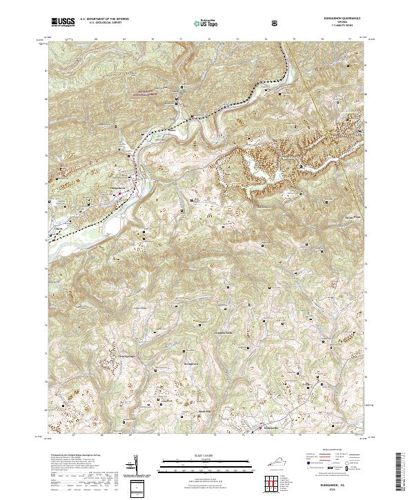
2022 Map of Dungannon
USGS Topo · Published 2022About this map
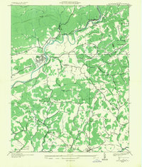
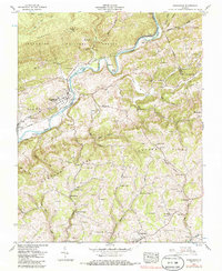
Dungannon sits along a broad bend of the Clinch River, serving as a central point in this part of Scott County where the valley floors meet steep ridges like Osborne Ridge and Chestnut Ridge. The landscape is characterized by a dense distribution of family-named cemeteries, such as Porter Cem, Dingus Cem, and the Osborne Family Cem, reflecting generations of local settlement in the hollows. To the south, Bush Mill and the crossroads of Nickelsville anchor a network of rural roads that wind through the valleys of Copper Creek and Cowan Cr.
Find a feature on this map
134 named features on this map. Tap any name to fly to it.
Don’t see what you’re looking for? This feature index may not catch every label — zoom into the map to look around manually.
Map Details
Editions of this 2022 Dungannon Map
This is the sole edition of this map. No revisions or reprints were ever made.
Historical Maps of Dungannon Through Time
3 maps found