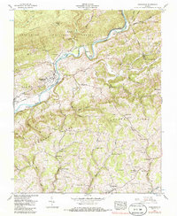
1957 Map of Dungannon
USGS Topo · Published 1986About this map
Dungannon sits at a strategic bend in the Clinch River, serving as a focal point for this 1950s survey of Scott and Russell Counties. The landscape is defined by the massive ridges of Osborne Ridge and Copper Ridge, which dictate the paths of the Clinchfield River and the regional rail lines. The presence of the State Prison Camp near Dungannon and the Townes Tunnel to the northeast highlights the intersection of state infrastructure and challenging mountain topography. Smaller rural communities like Nickelsville, Twin Springs, and Crackers Neck are connected by a network of winding roads and numerous country churches, such as New Bethel Ch and Wells Chapel. The map reveals a deeply settled agrarian and industrial valley where numerous family cemeteries, including the Chestnut Cem and Porter Cem, are tucked into the hollows and along the slopes of the Jefferson National Forest.
Find a feature on this map
95 named features on this map. Tap any name to fly to it.
Don’t see what you’re looking for? This feature index may not catch every label — zoom into the map to look around manually.
Map Details
Editions of this 1957 Dungannon Map
3 editions found
Other maps of this area

1894 · Estillville
USGS Topo · 1:125,000

1897 · Bristol
USGS Topo · 1:125,000

1902 · Bristol
USGS Topo · 1:125,000

1920 · Wise
USGS Topo · 1:48,000

1920 · Coeburn
USGS Topo · 1:48,000

1921 · Wise
USGS Topo · 1:62,500

1935 · Hilton
USGS Topo · 1:24,000
1935 · Wise
USGS Topo · 1:24,000

1935 · Moggasin
USGS Topo · 1:48,000

1935 · Mendota
USGS Topo · 1:24,000