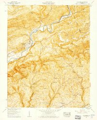
1957 Map of Dungannon
USGS Topo · Published 1960About this map
The Clinch River carves a winding path through the heart of the Appalachian terrain, where the Clinchfield railroad tracks follow the water's edge to serve the community of Dungannon. This mid-century landscape is defined by the sharp elevations of Osborne Ridge and Copper Ridge, much of which is protected within the Jefferson National Forest. The map reveals a deeply rooted rural society, evidenced by the high density of family-named landmarks and small crossroads like Twin Springs and Crackers Neck.
Find a feature on this map
79 named features on this map. Tap any name to fly to it.
Don’t see what you’re looking for? This feature index may not catch every label — zoom into the map to look around manually.
Map Details
Editions of this 1957 Dungannon Map
3 editions found
Other maps of this area

1894 · Estillville
USGS Topo · 1:125,000

1897 · Bristol
USGS Topo · 1:125,000

1902 · Bristol
USGS Topo · 1:125,000

1920 · Wise
USGS Topo · 1:48,000

1920 · Coeburn
USGS Topo · 1:48,000

1921 · Wise
USGS Topo · 1:62,500

1935 · Hilton
USGS Topo · 1:24,000
1935 · Wise
USGS Topo · 1:24,000

1935 · Moggasin
USGS Topo · 1:48,000

1935 · Mendota
USGS Topo · 1:24,000