
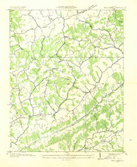
1935 Map of Mendota
USGS Topo · Published 1935About this map
Mendota sits at a strategic gap in the mountains where the Southern Railway follows the winding path of the North Fork Holston River. This 1935 field examination by the Tennessee Valley Authority reveals a landscape of high ridges and narrow valleys, defined by the massive barrier of Clinch Mountain and the parallel Moccasin Ridge. The region's early 20th-century transport economy is visible through the numerous river crossings, including White Ford, Fleenors Mill Ford, and Jett Ford, which served local travelers before the widespread construction of highway bridges.
Find a feature on this map
66 named features on this map. Tap any name to fly to it.
Don’t see what you’re looking for? This feature index may not catch every label — zoom into the map to look around manually.
Map Details
Editions of this 1935 Mendota Map
This is the sole edition of this map. No revisions or reprints were ever made.
Other maps of this area

1897 · Bristol
USGS Topo · 1:125,000

1902 · Bristol
USGS Topo · 1:125,000

1918 · Carterton
USGS Topo · 1:62,500

1920 · Coeburn
USGS Topo · 1:48,000

1934 · Wallace
USGS Topo · 1:24,000

1934 · Hansonville
USGS Topo · 1:24,000

1934 · Bristol
USGS Topo · 1:24,000

1935 · Hilton
USGS Topo · 1:24,000

1935 · Blountville
USGS Topo · 1:24,000
1935 · Moll Creek
USGS Topo · 1:24,000