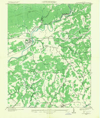
1935 Map of Dungannon
USGS Topo · Published 1935About this map
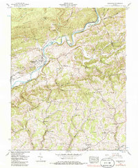
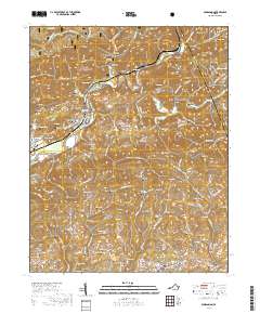
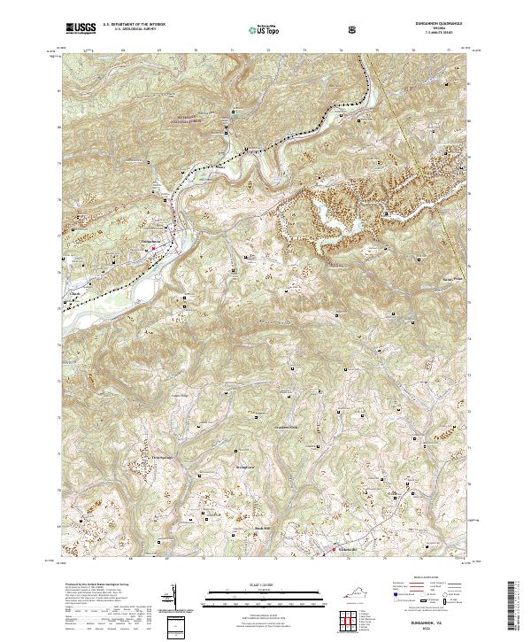
The Clinch River carves a deep path through the center of this 1935 survey, where the Clinchfield R R utilizes Townes Tunnel to navigate the steep terrain. Settlement is concentrated in the riverside community of Dungannon and the junction at Nickelsville, with the landscape dominated by parallel formations like Copper Ridge and Chestnut Ridge. The rural social fabric of the era is evident in the dense distribution of local institutions, including the Fincastle Sch, Twin Springs Sch, and Sinking Creek Ch. Agriculture and small-scale industry are represented by Bonds Mill and several family-named landmarks like Culbertson Chapel. This Tennessee Valley Authority collaboration captures the region just as the state highway system began modernizing older routes like the Clinchfield Highway, providing a clear view of the mountain valleys before mid-century changes altered the local infrastructure.
Find a feature on this map
67 named features on this map. Tap any name to fly to it.
Don’t see what you’re looking for? This feature index may not catch every label — zoom into the map to look around manually.
Map Details
Editions of this 1935 Dungannon Map
This is the sole edition of this map. No revisions or reprints were ever made.
Historical Maps of Nickelsville Through Time
7 maps found