2022 Map of Dunkerton
USGS Topo · Published 2022About this map
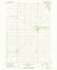
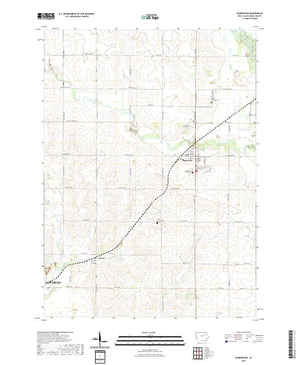
Dunkerton serves as the central hub of this agricultural landscape in Black Hawk County, situated along the winding course of Crane Creek. The surrounding territory is defined by a dense grid of rural roads, including Crane Creek Rd and Co Hwy V49, which connect the town to outlying settlements like Dewar and the northeastern edges of Waterloo. This modern survey by the U.S. Geological Survey preserves the locations of several burial grounds essential for genealogical research, such as Lester Township Cem and the Fairview Lester Cem. To the northeast, the Wapsipinicon River cuts through the corner of the map, while the southern reaches transition toward Barclay. The distribution of these features, alongside Elk Run and Poyner Cr, illustrates the enduring relationship between the region's drainage patterns and its long-established township divisions.
Find a feature on this map
47 named features on this map. Tap any name to fly to it.
Don’t see what you’re looking for? This feature index may not catch every label — zoom into the map to look around manually.
Map Details
Editions of this 2022 Dunkerton Map
This is the sole edition of this map. No revisions or reprints were ever made.