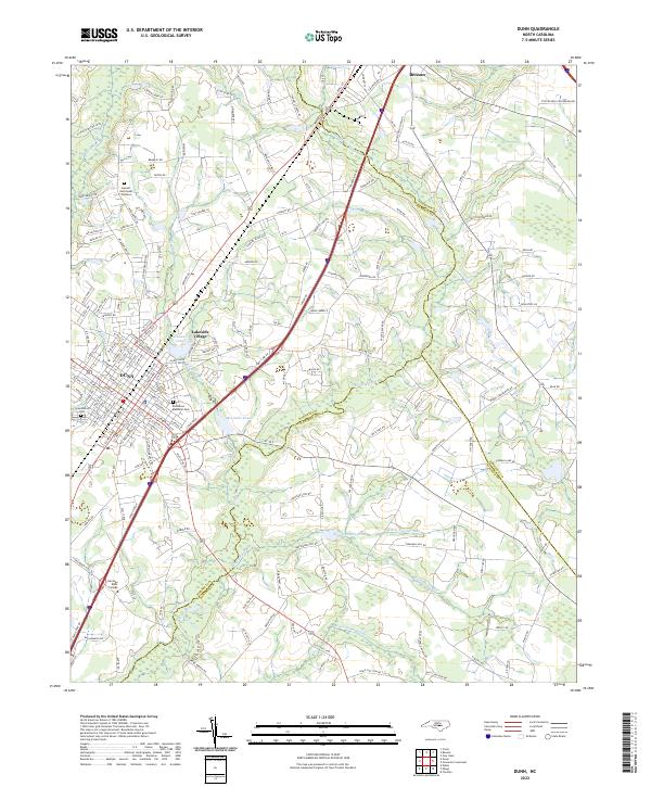
2022 Map of Dunn
USGS Topo · Published 2022About this map
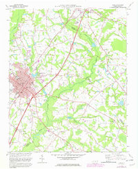
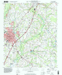
Dunn serves as the primary urban center for this portion of the Coastal Plain, situated where the borders of Harnett, Johnston, and Sampson counties converge. The local landscape is defined by an intricate network of wetlands and slow-moving water, most notably the Mingo Swamp and Beaverdam Swamp which drain the southeastern agricultural lands. Near the northern edge of the map, Benson marks a second hub of settlement. For those tracing local history, the map includes significant community landmarks such as Greenwood Cem and Resthaven Memorial Park, alongside the campus of Heritage Bible College. The presence of Harnett Devotional Gardens and smaller residential pockets like Lakeside Village near Hannas Lake illustrates the modern development pattern of this region, while names like Stony Run and Big Juniper Run preserve the nomenclature of the area’s traditional watercourses.
Find a feature on this map
170 named features on this map. Tap any name to fly to it.
Don’t see what you’re looking for? This feature index may not catch every label — zoom into the map to look around manually.
Map Details
Editions of this 2022 Dunn Map
This is the sole edition of this map. No revisions or reprints were ever made.