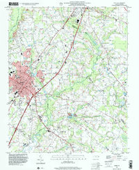
1997 Map of Dunn
USGS Topo · Published 2000About this map
The city of Dunn and the southern edge of Benson anchor this landscape, where the growing municipal footprint meets the rural agriculture of the North Carolina coastal plain. Historically significant landmarks such as Mary Stewart Sch and Heritage College appear alongside a dense network of community centers, including Lees Grove Ch and Black River Ch. The terrain is defined by its drainage into Mingo Swamp and Beaverdam Swamp, with the Black River cutting across the northwest corner. A notable geological feature is highlighted by dashed elliptical outlines representing Carolina Bays, which are unique shallow depressions common to this region. Transport and recreation are represented by the CSX Transportation railroad line and localized amenities like the Drag Strip near the Sampson County line, reflecting the late 20th-century mix of traditional crossroads and modern infrastructure.
Find a feature on this map
49 named features on this map. Tap any name to fly to it.
Don’t see what you’re looking for? This feature index may not catch every label — zoom into the map to look around manually.
Map Details
Editions of this 1997 Dunn Map
This is the sole edition of this map. No revisions or reprints were ever made.
Other maps of this area

1906 · Four Oaks
USGS Topo · 1:48,000

1908 · Four Oaks
USGS Topo · 1:62,500

1909 · Coharie
USGS Topo · 1:62,500

1953 · Raleigh
USGS Topo · 1:250,000

1954 · Raleigh
USGS Topo · 1:250,000

1973 · Benson
USGS Topo · 1:24,000

1973 · Dunn
USGS Topo · 1:24,000

1973 · Erwin
USGS Topo · 1:24,000

1973 · Coats
USGS Topo · 1:24,000
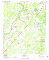
1974 · Wade
USGS Topo · 1:24,000