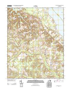
2013 Map of Dunnsville
USGS Topo · Published 2013About this map
Dunnsville and the surrounding riverfront settlements of Essex and King and Queen Counties sit at a unique geographic crossroads where the Rappahannock River meets a vast network of coastal lowlands. The landscape is defined by its numerous drainages, such as Dragon Swamp, Mussel Swamp, and Yorkers Swamp, which have historically shaped the placement of roads and landings. Historically significant waterfront access points like Wares Wharf and Bowlers Wharf emphasize the region's long-standing connection to the river economy.
Find a feature on this map
35 named features on this map. Tap any name to fly to it.
Don’t see what you’re looking for? This feature index may not catch every label — zoom into the map to look around manually.
Map Details
Editions of this 2013 Dunnsville Map
This is the sole edition of this map. No revisions or reprints were ever made.
Other maps of this area

1917 · Urbanna
USGS Topo · 1:62,500

1917 · Morattico
USGS Topo · 1:62,500

1918 · Tappahannock
USGS Topo · 1:62,500

1918 · Morattico
USGS Topo · 1:62,500

1919 · New Kent
USGS Topo · 1:62,500

1919 · Tappahannock
USGS Topo · 1:62,500

1926 · Morattico
USGS Topo · 1:62,500

1943 · Richmond
USGS Topo · 1:250,000

1944 · Mount Landing
USGS Topo · 1:31,680

1944 · Tappahannock
USGS Topo · 1:31,680