
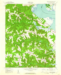
1944 Map of Mount Landing
USGS Topo · Published 1944About this map
Blandfield Farm and the surrounding marshy lowlands of the Rappahannock River anchor this mid-century survey of Essex County. The interior landscape is defined by a dense network of swampy creek systems, such as Griddlin Swamp and Thurston Swamp, which dictated the placement of early infrastructure. The local economy and social life are centered around crossroads like Mount Landing and Whitlock Forks, while spiritual and educational hubs like Mt Zion Ch and Hickory Road Sch serve the rural population.
Find a feature on this map
44 named features on this map. Tap any name to fly to it.
Don’t see what you’re looking for? This feature index may not catch every label — zoom into the map to look around manually.
Map Details
Editions of this 1944 Mount Landing Map
2 editions found
Other maps of this area

1889 · Fredericksburg
USGS Topo · 1:125,000

1892 · Fredericksburg
USGS Topo · 1:125,000

1892 · Montross
USGS Topo · 1:62,500

1894 · Fredericksburg
USGS Topo · 1:125,000

1895 · Nomini
USGS Topo · 1:125,000

1895 · Montross
USGS Topo · 1:62,500

1898 · Nomini
USGS Topo · 1:125,000

1918 · Tappahannock
USGS Topo · 1:62,500

1918 · Aylett
USGS Topo · 1:62,500

1919 · Tappahannock
USGS Topo · 1:62,500