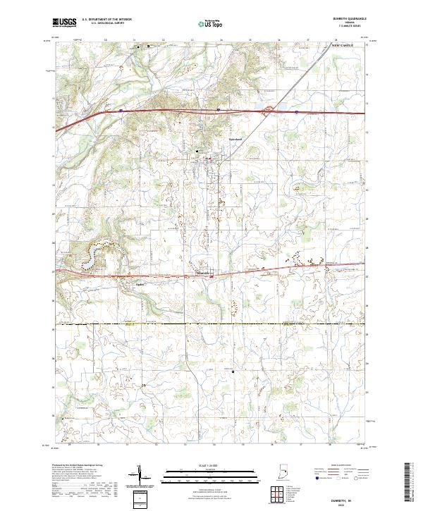
2022 Map of Dunreith
USGS Topo · Published 2022About this map
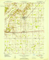
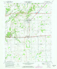
Spiceland and Dunreith serve as the primary hubs in this portion of Henry County, reflecting a landscape defined by the traditional grid of rural Indiana. The area is marked by a high concentration of small, family-associated burying grounds such as Mason Cem, Hicksite Cem, and Reddick Cem, which offer significant value for genealogical research. The Big Blue River meanders across the northern half of the quadrangle, joined by smaller tributaries like Duck Cr and Buck Cr, while the Little Blue River drains the southern landscape. The transition from the historic National Rd corridor to modern infrastructure is evident here, as the survey shows the intersection of local history at Ogden with the broader reach of the interstate system. This map captures the persistent small-town character of the region, anchored by landmarks like the Circle Grove Cem and the natural water source at Knightstown Spring.
Find a feature on this map
66 named features on this map. Tap any name to fly to it.
Don’t see what you’re looking for? This feature index may not catch every label — zoom into the map to look around manually.
Map Details
Editions of this 2022 Dunreith Map
This is the sole edition of this map. No revisions or reprints were ever made.