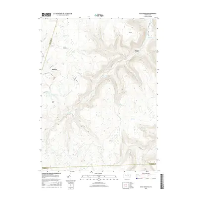
2016 Map of Dutch Mountain
USGS Topo · Published 2016About this map
Mehoopany Creek carves a deep path through this portion of Wyoming County, where the high plateaus of Dutch Mountain and Short Mtn dominate the topography. The small settlement of Bellasylva serves as a local landmark on the western edge, while Kasson Brook sits to the northeast. This region is characterized by extensive wetlands and high-elevation bogs, such as Crane Swamp, Tamaraek Swamp, and Coalbed Swamp, which collect headwaters for the numerous brooks and runs that drain the mountainside. The landscape is also marked by family-named heritage sites like Fincke Cem and Junk Cem, reflecting the early rural community that settled these heights. Near Schmitthenner Lake, the network of local roads such as Windy Valley Rd and State Rte 3001 connects these isolated homesteads and natural features across the Sullivan and Luzerne county borders.
Find a feature on this map
45 named features on this map. Tap any name to fly to it.
Don’t see what you’re looking for? This feature index may not catch every label — zoom into the map to look around manually.
Map Details
Editions of this 2016 Dutch Mountain Map
This is the sole edition of this map. No revisions or reprints were ever made.
Other maps of this area

1891 · Harveys Lake
USGS Topo · 1:62,500

1893 · Harvey Lake
USGS Topo · 1:62,500

1934 · Laporte
USGS Topo · 1:62,500

1943 · Monroeton
USGS Topo · 1:62,500

1945 · Meshoppen
USGS Topo · 1:62,500

1945 · Jenningsville
USGS Topo · 1:24,000

1945 · Meshoppen
USGS Topo · 1:24,000

1946 · Dutch Mtn
USGS Topo · 1:24,000

1946 · Harveys Lake
USGS Topo · 1:24,000

1946 · Noxen
USGS Topo · 1:24,000
Featured Places
- Noxen Township, PA
- Colley Township, PA
- Forkston Township, PA
- North Branch Township, PA
- Bellasylva, Forkston Township