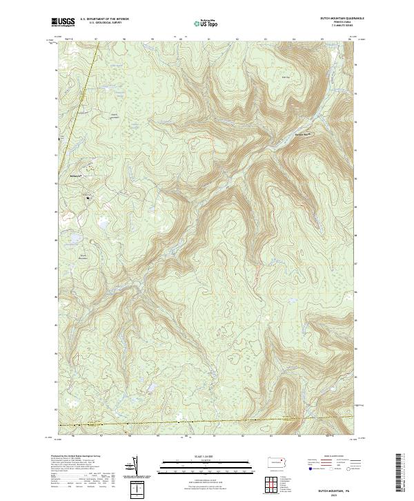
2023 Map of Dutch Mountain
USGS Topo · Published 2023About this map
Dutch Mountain and the surrounding high plateau of Wyoming County define this landscape, where early 21st-century surveys record a network of upland swamps and headwater streams. The settlement of Bellasylva serves as a primary reference point in a region characterized by its hydrography, including Crane Swamp, Tamarack Swamp, and Coalbed Swamp. These wetlands feed various drainage systems such as Loyalsock Creek and Mehoopany Creek, which have shaped the local geography over generations.
Find a feature on this map
41 named features on this map. Tap any name to fly to it.
Don’t see what you’re looking for? This feature index may not catch every label — zoom into the map to look around manually.
Map Details
Editions of this 2023 Dutch Mountain Map
This is the sole edition of this map. No revisions or reprints were ever made.
Other maps of this area

1891 · Harveys Lake
USGS Topo · 1:62,500

1893 · Harvey Lake
USGS Topo · 1:62,500

1934 · Laporte
USGS Topo · 1:62,500

1943 · Monroeton
USGS Topo · 1:62,500

1945 · Meshoppen
USGS Topo · 1:62,500

1945 · Jenningsville
USGS Topo · 1:24,000

1945 · Meshoppen
USGS Topo · 1:24,000

1946 · Dutch Mtn
USGS Topo · 1:24,000

1946 · Harveys Lake
USGS Topo · 1:24,000

1946 · Noxen
USGS Topo · 1:24,000
Featured Places
- Noxen Township, PA
- Colley Township, PA
- Forkston Township, PA
- North Branch Township, PA
- Lake Township, PA